This site is available in multiple languages: Deutsch, Русский, عربي.
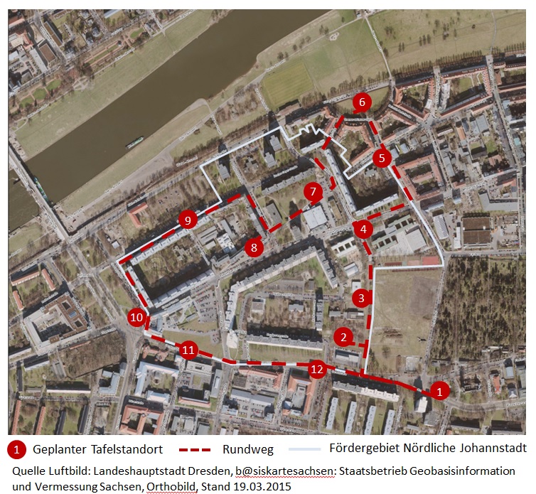
The aerial attacks of February 13-14, 1945, left the majority of Johannstadt in rubble and ashes. An entire neighborhood almost ceased to exist, leaving only traces behind. But Johannstadt lived on, and in the years that followed it developed into an important, centrally-located residential and industrial area. With the support of the state and federal programs, “Soziale Stadt / Sozialer Zusammenhalt”, information panels will be placed at 12 historical locations within and around the funding area “Nördliche Johannstadt”. They are connected by a path starting and ending at Trinitatisplatz with the aim of bringing the neighborhood’s varied past to light.

Head directly to the individual locations:
- Trinitatisplatz
- Johanngarten
- Lili-Elbe-Straße
- Pfotenhauerstraße
- Arnoldstraße
- Thomas-Müntzer-Platz
- Stadtteilhaus, formerly Blumenstraße
- Bönischplatz
- Florian-Geyer-Straße
- Güntz- / Sachsenplatz
- Gerok- / Marschnerstraße
- Gerok- / Silbermannstraße
The idea originated locally: 2017 till 2020, a public working group comprised of the Johannstadtarchiv, interested residents, the offices of evergreen landschaftsarchitekten and Quartiersmanagement Nördliche Johannstadt has been compiling relevant information and photographic material. Information is translated into Russian, Arabic and English, and published on this website.
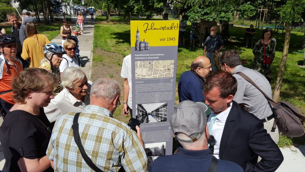
The first panel, located in the “Johanngarten” behind the Johannstadt rescue center, was unveiled in 2017. The second panel at Bönischplatz followed in 2020, the third at Lili-Elbe-Straße in 2023. In 2024, the panels at the locations no. 1, 4-6 und 9-12 will follow. The panel at location no. 7 will follow with the construction of the new “Stadtteilhaus” 2025.

Text: Matthias Kunert, QM Johannstadt
