This site is available in multiple languages: Deutsch, Русский, عربي.
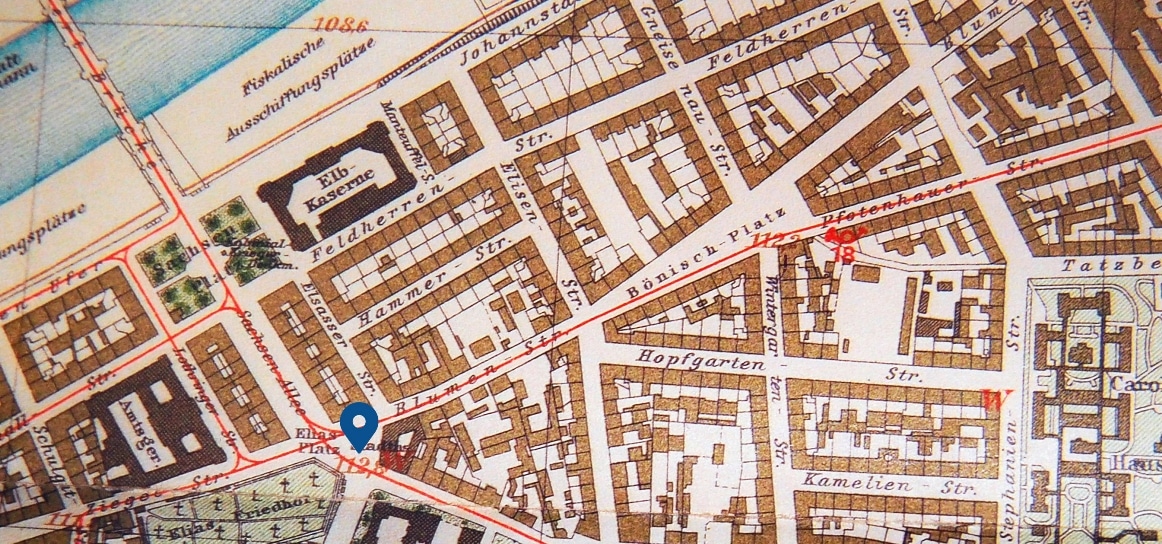
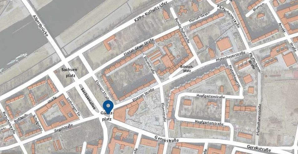
Follow Florian-Geyer-Straße in the direction of Sachsenallee and turn left onto Elsasser Straße. At Güntzplatz you will reach the 10th location along the historical walking tour.
Before 1945: Güntz, gold and graves
Sachsenallee, Sachsenplatz and Eliasplatz
The establishment of Sachsenplatz and Sachsenallee accompanied the completion of construction on the Albertbrücke in 1878. Representative reseidential and commercial buildings could be found on both sides of Sachsenallee, south of the junction with Feldherrenstraße/Marschallstraße. The continuation of traffic going south proved to be difficult, because circulation needed to be routed around the eastern side of Eliasfriedhof. For that reason, a redesign of Eliasplatz (today Güntzplatz) was begun in 1877. In total, negotiations regarding the redesign lasted 70 years, before the separation of 700 square meters of cemetery land allowed for the optimization of traffic routing, in 1947.
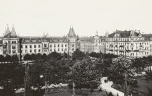
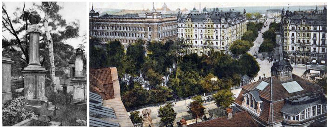
Right: View of Sachsenallee, from the school of decorative arts, ca. 1910. On the left is the district court, which still stands today. Along the bottom edge, Eliasfriedhof with its prior dimensions. Photo: unknown, Source: Landeshauptstadt Dresden, Stadtplanungsamt
The double square has always been an important traffic hub. On March 19, 1872, construction of the first horse-drawn tramway to Blasewitz began here. A particular gem at Güntzplatz is an advertisement column from the year 1927, the oldest remaining of its kind in Dresden: a cylinder, a graduated top and a globe, in expressionistic forms.
During the Nazi period, streets and public squares named after Jews or the “first-degree mix-raced” were all given new names. This affected Eliasplatz and Eliasstraße, as well, as they carried the name of the biblical prophet, Elijah. In 1938, they were renamed Güntzplatz and Güntzstraße, after Dresden businessman, Dr. Justus Friedrich Güntz (1801-1875).
Eliasfriedhof
Eliasfriedhof at Güntzplatz is one of the oldest extant cemeteries in Dresden. In 1680, due to an outbreak of the plague, it was established on the empty field, and then when the plague had abated, it continued on as a paupers’ cemetery. When the Frauenkirche cemetery closed in 1724, Eliasfriedhof was selected as the cemetery for the upper classes. Burials continued here until 1876. Eliasfriedhof contains countless remarkable tombstones from the Baroque period up to through the Historicism period.
Find more information on the history of Eliasfriedhof here.
Johannstadt town hall
The impressive town hall was completed in 1913/14 according to designs by Dresdner city planner Hans Erlwein (1874–1914). For its construction, it was necessary to demolish a building previously being used as a savings bank. The new building contained a branch of the savings bank and several shops, including a branch of “Pfunds Molkerei” and the “Eliascafé”. City maintenance quarters, including those for street-cleaning, could also be found in its inner courtyard.
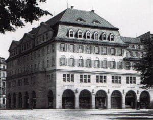
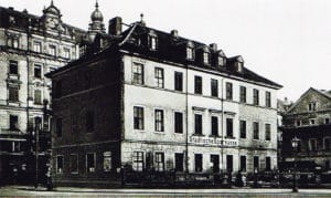
Find more information on the history of Johannstadt town hall here.
After 1945: Rebuilding and World Festival
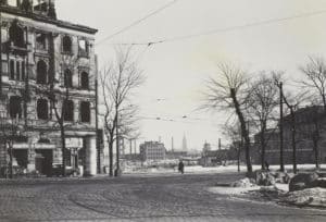
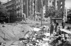
Rubble removal and rebuilding
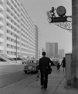
At the beginning of the 1970s, after large-scale rubble clearance of Johannstadt with the railways (T2 line) and waste deposit at Käthe-Kollwitz-Ufer, development of Elsasser Straße started with 11-story pre-fabricated high-rises (type IW 66). Of note is the design of the gable wall at Elsasser Straße 9, built in 1973 for the 10th World Festival in Berlin.
Sparkasse and Ostsächsische Sparkasse Dresden
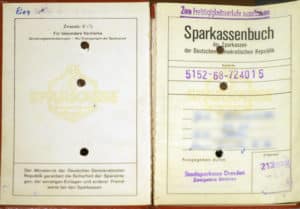
Though severely damaged during the aerial bombardments of February 13 & 14, 1945, Johannstadt’s townhall was one of the few buildings in Johannstadt that survived the rubble clearance of the post-war times. The banker Curt Kirschner, the first bank director after 1945, played a significant role in the preservation of its nearly ruined structure. By expanding rooms on the ground floor, the premises could already be used in May 1949 in a makeshift fashion. Kirschner also made sure that the townhall housed the headquarters of the Dresdner Sparkasse after its reconstruction. For his actions, Kirschner lost his job and was sentenced to one year in prison. Since 2015, a panel on the building has paid tribute to his memory. The building was completely renovated in 1995-97, and is today the headquarters of the Ostsächsische Sparkasse. The upgrade to the complex included a modern annex on Gerokstraße and on Elsasser Straße. A portion of the exhibits on display in the Sparkasse museum—located here since 2015—deal with the topic, and can be found amid their special exhibits.
District and state court
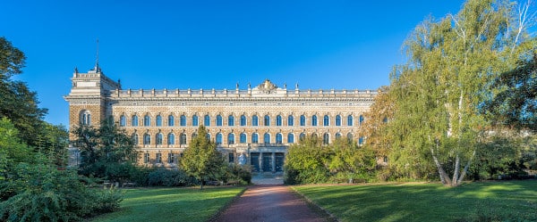
After rubble clearance, the city declined to rebuild the buildings on the east and west sides of Sachsenallee, opting instead to set up green spaces there. Thanks to this decision, the view from Güntzplatz and Sachsenplatz now extended all the way to the district and state court on Lothringer Straße. The formerly four-winged building—built as the Royal Saxon District court between 1888 and 1892, according to plans by Arwed Roßbach—only had three of its wings rebuilt after the war. The main gate is flanked by the figures of “Truth” and “Justice” by Johannes Schilling. In GDR times, the Dresden circuit court was located here, which turned into into the state court in 1993. Since 2012, the building has been linked structurally with the newly-built district court.
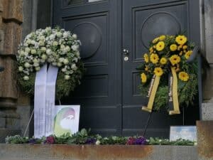
The state court garnered worldwide attention on July 1, 2009, when during criminal appeal proceedings, the defendant, acting with xenophobic motive, stabbed and killed an Egyptian-born witness for the prosecution, Marwa El-Sherbini, and severely injured her husband. Marwa El-Sherbini, three months pregnant at the times, bled to death in front of her three-year-old son. The murder drew international attention from the media and sparked protests in the Muslim world. Civic powers every year since have organized the Marwa El-Sherbini Commemoration.
Text: Matthias Erfurth, Matthias Kunert, Henning Seidler
Editorial deadline: January 2024
